| Tropical Ecology: Maps & Geography |
|
| Tropical Ecology: Maps & Geography |
|
Maps
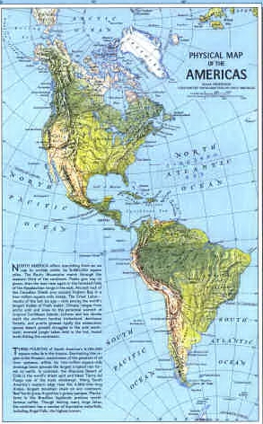
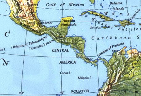
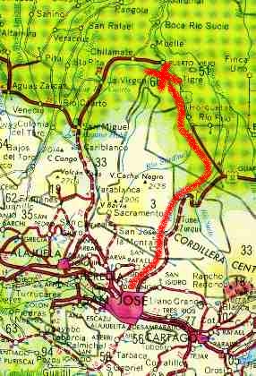
So you know where you are going, and so you can show your friends and family, here are some maps. Click on each one to get a better view.
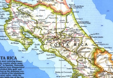
Costa Rica, the country
Costa Rica is a beautiful country. It is also a small country. The population is between 3 and 4 million and on some days it seems like every one of them is trying to drive in San Jose, the capital. Actually, a huge percentage of the total population, roughly 1/3, live in San Jose.
Costa Ricans, particularly those in San Jose, regard themselves as very modern, which in fact they are. If you asked a person in San Jose whether they had electricity, they would look at you with about the same look as would a person from Kingston, Ontario if asked the same question, i.e. "how else would I plug in my stereo?"
A recent article in Wired magazine, April 1998, revealed that "[computer] chips have surpassed Costa Rica's traditional exports, coffee and bananas. In fact Intel's $700 million in exports is double what the nation earned from coffee over the same period and equal to one-fifth of the republic's annual export revenues." The amazing thing is that this is the product of only the first of four Intel microchip plants in Costa Rica. To put things in perspective, however, "Costa Rica's GNP [Gross National Product] in 1997 hit $9.5 billion, while Intel's revenues worldwide were $25.1 billion."
Life in the countryside is a little more simple, but on average Costa Ricans are well-educated, knowledgable people. The country has an excellent public health care system, much like that in Canada. Costa Ricans are also proud of their country and they have good rights to be. They have accomplished what no other Latin American country has, namely a stable democracy and high standard of living. They have also accomplished environmental protection on a level far beyond either Canada or the U.S.
The normal language is Spanish, though many people speak English, to varying degrees. You can get by in Costa Rica with little or no knowledge of Spanish, though the more you now, the more you can really get immersed in the culture. Unfortunately, I have very limited knowledge of Spanish, though I am trying to improve.
Time Zone
Costa Rica is on Central Standard Time, i.e. it is one hour earlier in San Jose than it is in Ontario. They do not change to Daylight Savings Time (any guesses why?)
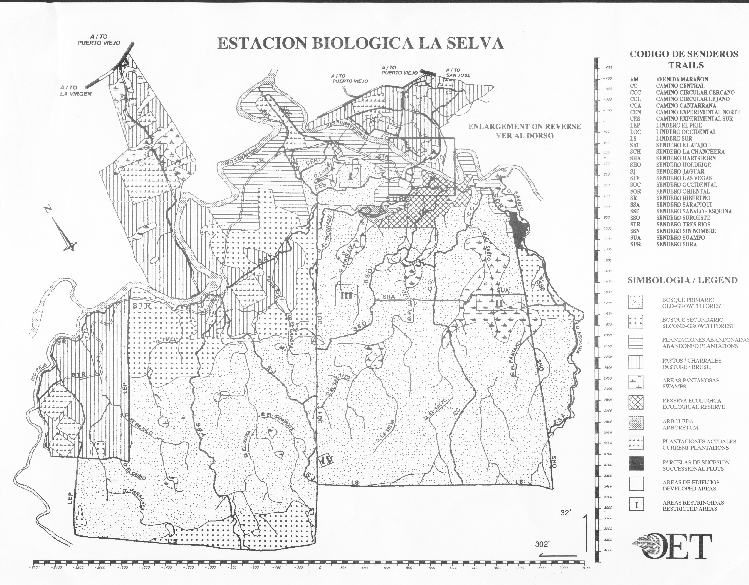
La Selva Trails
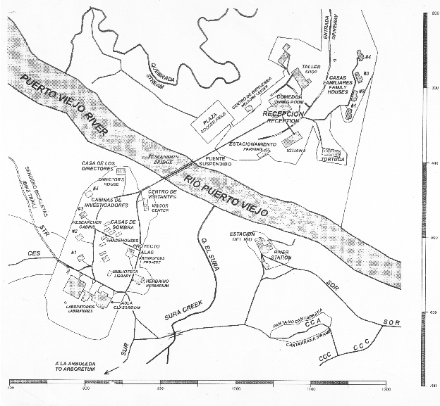
The map on the left shows the overall view of La Selva -- it is large and complicated. The map on the right is more useful -- it focuses on the areas around the "lab clearing" where we will be based. We arrive at La Selva via the road in the upper right and the first building we encounter is the Dining Hall. Nearby are the dorms where we will be staying. Then we cross over the large suspension bridge which serves as the gateway to the forest.
On the south side of the river there is an extensive series of trails, far more than we can ever cover in a week. You do not need to learn all the trail names, but it would be very helpful to know a few. Trails are labelled either as "Sendero" or "Lindero".
If you look at the map on the left you will notice that the trails divide La Selva into chunks. The reason is that as La Selva has grown, each time land was acquired, a perimeter trail was established. These are the "Linderos". Because Linderos follow the property edge, they are often straight, BUT they are also cut without regard to making the walking any easier, i.e. some of them have a lot of nasty ups and downs.
Senderos more often follow the contours of the land.
Trails are labelled with a three letter code, e.g. SOR, this code is posted on all the signposts. A signpost saying SOR 500 means you are on the Sendoro Oriental, 500 meters from where the trail starts. In general, trails start close to the lab clearing, so if you get lost, walk towards a lower number. This will get you closer to the lab clearing.
CAUTION: La Selva is a large place: it is several hours brisk walk to get from the LS trail at the back of the property to the lab clearing.
Important trails to know
The SOR is the trail we take to go snorkelling -- it runs from the River Station along the side of the Rio Puerto Viejo.
The SUR goes to the Arboretum.
The STR is a wide concrete trail that goes along the Rio Sarapiqui. It was put in place for rapid access to the back of the property (and is bicycle and wheelchair accessible). Be warned, it can be slippery (as can all the trails).
![[Go Back to Contents]](../gifs/back.gif) |
![[Send email to Ron Coleman]](../gifs/address.gif) |
|
![[Go to Contents of Cichlid Research Home Page]](../gifs/cichres.gif)